One of the greatest features of the Pisgah National Forest is the availability of great hiking and backpacking opportunities. We only deal with the Pisgah Ranger District here – but the Pisgah District has about 400 miles of trails, so there are plenty of hikes to take just in this district.
One of our most frequently asked questions we get at the Ranger Station is “What is a good hike to take?” The answer is not so easy, and we almost always have to ask a few questions in return: How long a hike? How strenuous a hike? What would you like to see? We also take some clues from how people are dressed, shoes they are wearing, time of day, weather conditions, etc. We really try and get people out on a hike they will enjoy, and which will not wear them out, and where they will be safe. The hike will only be good if it suits the weakest member of the group.
The Pisgah Visitor Center has a kiosk with a computer and touch-screen Trail Finder Application. If you want to research your own hike, you can use this device. It will ask some questions about your desired hike, and will make some recommendations for you. In May of 2015 the Forest Service and the Cradle of Forestry Interperative Association introduced a new cell phone application that also provides a wealth of information about hiking, biking, and points of interest. I is currently free – but will soon cost a moninal amount. Go to the App store and search for ” Pisgah NF ” to download it. It requires a good internet connection because of the amount of data to download.
It is important to be prepared for your hike. Be sure to bring along the Ten Essentials for hikers listed at bottom of this page.
All that being said – here are some of the most popular hikes and hiking locations as well as some comments on some other hikes. We’ve put them in alphabetical order. We also highly recommend that you have a Trail Map. We never go out on a hike without ours, and we almost always end up referring to it. Pisgah maps can be purchased at the Ranger Station, online, and at the Cradle of Forestry and local outfitters.
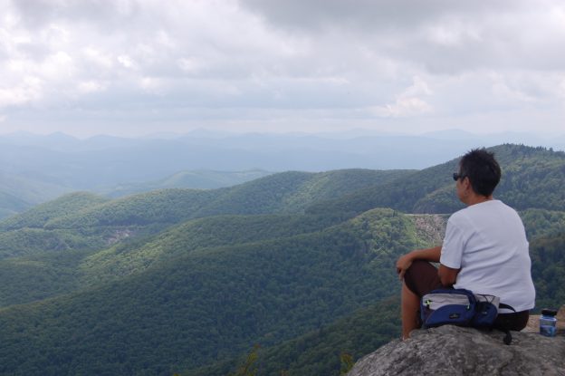
Cat Gap Loop Trail including the John Rock Summit Trail. Our personal trail rating is a 5 out of 5 – one of our favorite hikes in the district. We recommend this one a lot, and it is a very popular Pisgah hike. We do the loop clockwise, leaving from the end of the parking lot at the Pisgah Center for Wildlife Education. The hike is moderate. We like the hike for the diverse types of plants and trees encountered and the super view of Looking Glass Rock seen from the rock face of John Rock. Maps show the Cat Gap Loop distance to be 4.4 miles, and the John Rock Trail to be 1.8 miles. Taking the Cat Gap Bypass knocks a little off the hike. It will end up being almost 6 miles total.
Coontree Loop Trail. Our personal trail rating is a 1 out of 5. It is easy to get to since it is across the highway from the Coontree Picnic Area. Most people hike this trail in a counter-clockwise direction. We see little reason to do the trail. It’s fairly strenuous (moderate on the maps) and offers few views – just a wooded trail hike. It weighs in at 3.7 miles.
Daniel Ridge Loop Trail. Our personal trail rating is a 4 out of 5. We like to do the loop in a clockwise direction. We like this hike because it starts out with a crossing of the Davidson River and then it parallels the river for a while where there are several nice cascades and the remains of an old hatchery. It then climbs to a ridgetop, turns right, and descends through woods until it emerges near Daniel Ridge Falls (also called Jackson Falls and Tom Spring Falls). From the top of the falls a switchback leads to a Forest Service Road for the return to the parking lot. At the bottom of the switchback go to the left for a little ways to view the falls from below. Offering nice river views and a decent waterfall, this is one of our favorite hikes. We’d call it a moderate hike. The maps show it as 4 miles, but we think it is a little longer. We’re not sure the measurement is from the start of the actual trail, or from the parking lot.
Pink Beds Loop Trail. Our personal trail rating is a 4 out of 5. This popular loop can be either a 3 or a 5 mile loop that is rated easy. There are few hills, and that also means no views. The shorter hike makes use of the Barnett Branch trail that bisects the pink beds loop. The Barnett Branch cut-off has a wonderful boardwalk across the creek. New walkways have made it easier to get past the area where the beavers have been busy for years. They create pretty ponds, but often created flooding on this trail before the walkways were completed. It is usually a good flower hike.
The Trail Finder will recommend some hikes that are referred to as ‘composite’ hikes – what I would refer to as combined hikes because they use more than one trail to make up the complete hike. Some are hiking only trails and some are for mountain biking. We’ll talk about the hiking routes on this page.
Pisgah Forest Composite or Combined Hikes.
These composite or combined hikes use more than one trail to make a loop. We often get requests for hikes which people have not done before, or which are of a certain length or difficulty. Since there are about 400 miles of hiking trails in the Pisgah District, hikes combining multiple trails and forest service roads can be pieced together to make a great hike. Trails listed below are combined hikes that might interest you. The descriptions are pretty comprehensive, but we still recommend that you obtain a trail map of the district to easily follow the instructions. You can order a trail map from amazon on this page, obtain one at the ranger station visitor center, or find them at area outfitters. I recommend the South Pisgah Ranger District Trail Guide because of it’s map scale – it’s easier to read.
Graveyard Fields Composite Trail – Graveyard Fields Upper and Lower Falls Combined Trail Hike.
Hike Length: approximately 3.0 miles.
Overall Trail Rating: Easy.
Trailhead: Graveyard Fields Parking Lot – Blue Ridge Parkway near mile marker 422. Trail Usage: Hiking Only! Trail Features: Meadows, Waterfalls, Views. This easy hike visits two waterfalls in the Graveyard Fields area off of the Blue Ridge Parkway. A popular hiking spot that’s heavily travelled.
Hike Description: – This hike starts at the Graveyard Fields overlook parking lot. Take Trail 358A – blazed orange – to the left from the parking area. This trail leads to Upper Yellowstone Falls. In order to view the falls you will need to go upstream a little ways when you reach the river. After viewing Upper Falls, backtrack on 358A and bear left onto Trail 358C – blazed blue – to Lower Falls. From Lower Falls continue to the right on Trail 358A to return to parking area.
Note: There is a third falls below Second Falls called Yellowstone Falls, but there is no trail to it. Warning – It is a dangerous, steep and very difficult climb – not a hike. This falls is partially visible from the Blue Ridge Parkway. Someone we know that visited it stated that you must be at least a Green Beret to get there.
- The Best Hikes of Pisgah National Forest
– Buy this book at amazon.com to see loads of hikes you can do in the Pisgah Ranger District.
- Combine this book with the National Geographic Trails Illustrated Pisgah National Forest Trail Map #780, Publisher – National
to really plan your trip in advance.
- We like this map – South Pisgah Ranger District Including Bent Creek
-more than the National Geographic because it is easier to read.
Hiking Safety
There have been many versions of “The Ten Essentials” for hiking written. It may seem like overkill, but we regularly have hikers get lost on the trail. We’re fortunate now that some areas have cell phone coverage and they can call to get help. If you are lost in an area where you can not call for help, these items could save your life or at least make an unplanned night in the woods more comfortable.
-
Map and compass – so you do not get lost.
-
Flashlight and batteries – if you get caught out later than planned.
-
Matches, candle or firestarter – make sure matches are protected – if you need to make a fire to warm up.
-
Small knife – for cutting kindling, rope, etc.
-
First aid kit – carry items that take care of blisters, headaches, scrapes.
-
Sunglasses, sunscreen and mosquito repellent.
-
Mirror and whistle – for signaling for help if lost or injured.
-
Rain gear and extra clothing – plan for the worst weather you could expect to see.
-
Water – at least one quart – also purification tablets or filters
-
Extra food – high energy snacks such as candy, jerky or meat bars